
Day 1-
Left Friday Harbor for Bedwell Harbor to clear Customs, then went on to Montague Bay for the night. Got in the skiff and headed to the Ferry terminal on Mayne Island in Village Bay to pick up my girlfriend Fallon. This works well for a rendezvous spot for anyone coming from mainland Canada or Vancouver Island.
Day 2-
Left for Dodd Narrows and Nanaimo to provision. Anchorage was full and we had to anchor twice as there was very little room. Forecast for more wind around the corner has the crew tempted to wait till calmer waters in the Strait of Georgia.

Testing the anchor buddy out. Cant believe a waited this long to buy one.


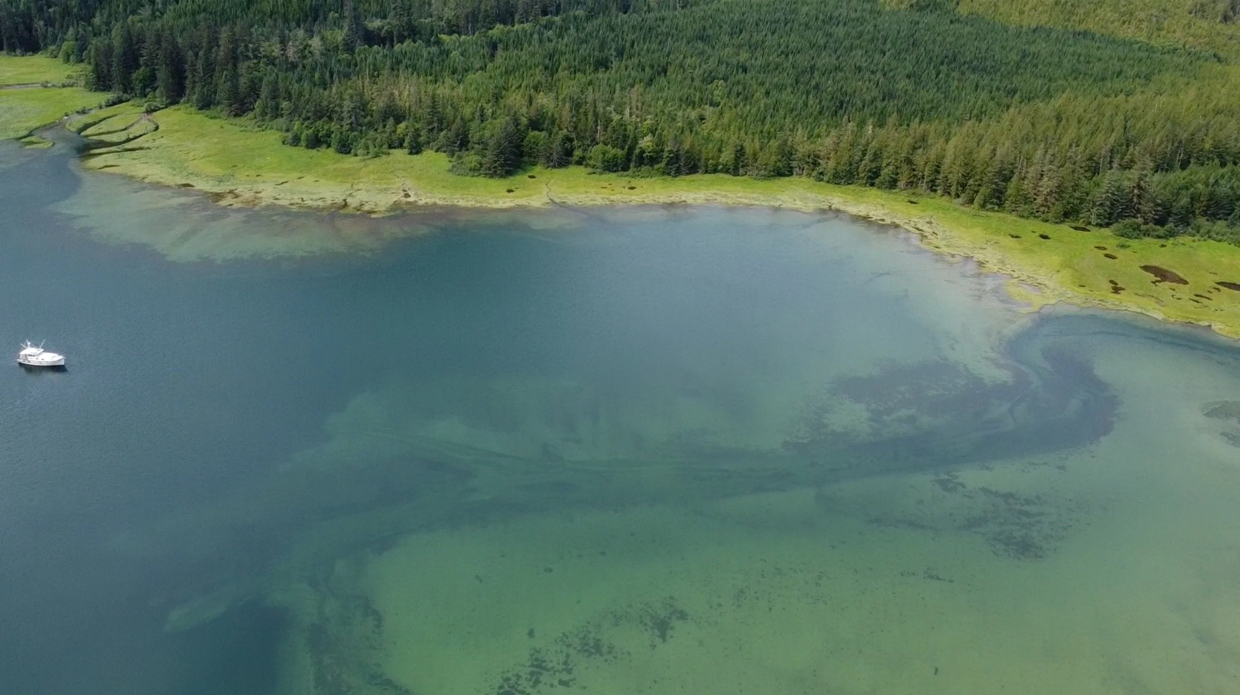
Ten cruising guides paired with the Starlink, Navionics reviews, and hours a day are what it takes find the sweet spots in these cruising grounds. Even then may trailheads were overgrown but that makes it feel like a real adventure.
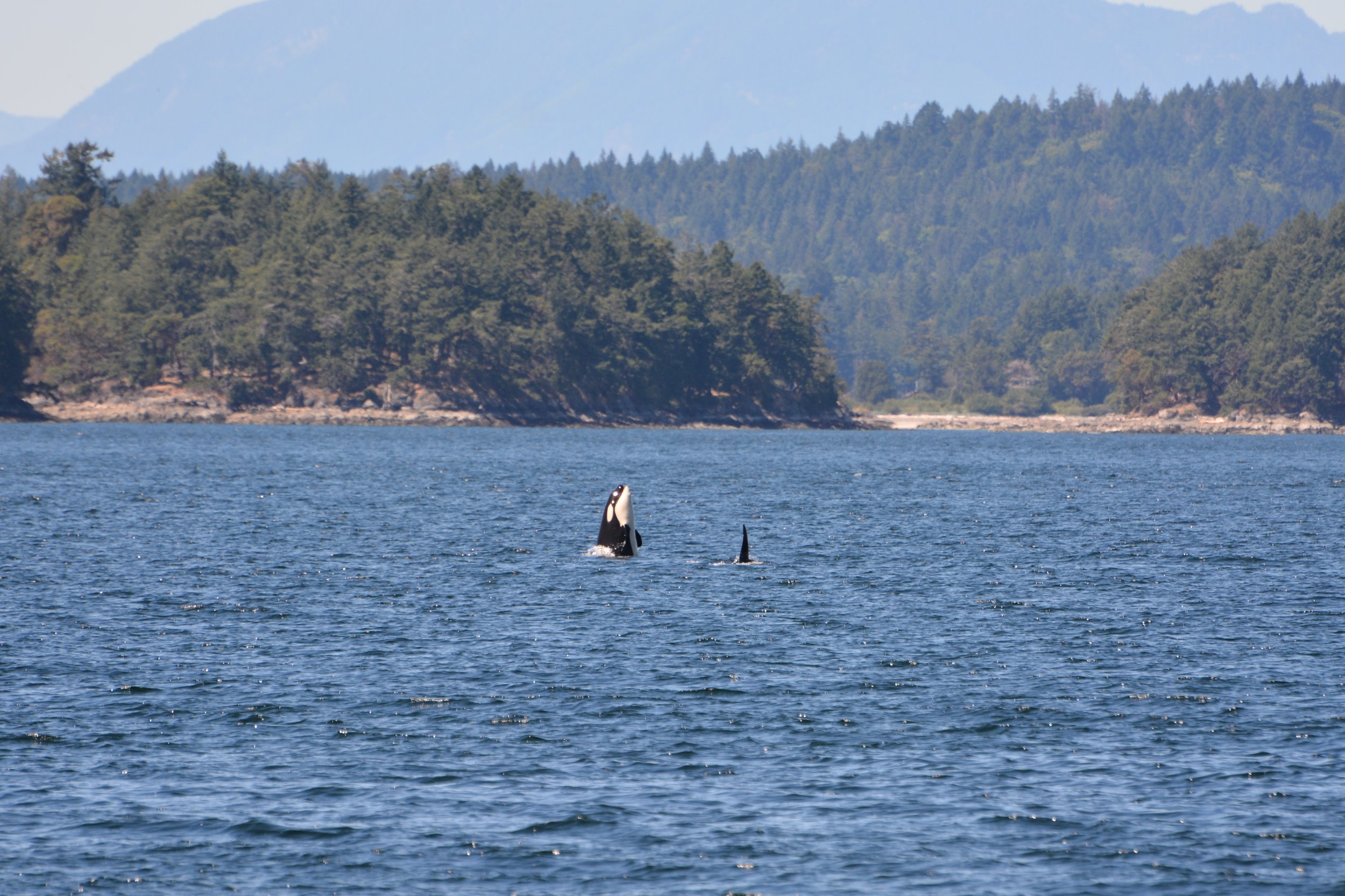
One of the young additions to the L pod checking us out. Seeing these two healthy Orca kids playing around makes us hopeful that this pescatarian subset of the species will not go extinct.


Day 3-
Provisioned and headed to Hornby Island. The rounding was nothing the Rose even hesitated at, 20+ knots on the nose, and towing the dinghy was no problem. Fallon and I kayaked and swam in the bay on the south shore of the island. I can see why this is a destination for Canadians in the area. Got back to the Rose and tied the Kayaks to the skiff which got loose later that evening and all were brought back to us by a friendly boater anchor downwind. Noted to keep paddles on the big boat and kayaks tied separately… as well as other things… knots are the foundation of seamanship skills but there is an argument for having painters with clips.

Parents providing scale for this deceptively large vessel
Day 4-
Spent the night ashore camping in Desolation Sound’s Cochrane Bay. This is the end of a well-known hiking trail. The anchorage was the smallest we’ve been in yet. Quietest Fourth of July to date eh?
Day 5-

Headed Beaver Inlet passing Shoal Bay and temporarily anchoring in Tallac Bay while waiting for the current to slow to transit Green Point. Took the skiff to Blind Bay on West Thurlow Island to walk to the big cedar. This was the best hike and we wished we had more time to do the full loop. We also bought an expensive cucumber. Having to do your perishable provisioning after crossing the border and in a place like Nanaimo is unfortunate. The grocery store in Nanamo is expensive and poorly stocked. Perhaps it’s worth getting a cab inland to a better store or doing all your produce shopping at the Saltspring Farmers Market.
Day 6-
Headed for West Cracroft Island and Lagoon Cove. Decided not to head down the turbulent channel (Blow Hole) with the big boat and opted to anchor in Cutter Cove and take the dinghy in. There was a big table full of cruisers tucking into a prawn dinner when we got there and went for our short/not-so-short hike. The signs were a little misleading and there were a few new additions to the trail. Still worth it.

Lagoon Cove

The marina shop


There are not many spots to get ashore and hike so it is important to try and get ashore when you can and stretch your legs. Physical and mental health aboard is key as is diet and mindful communication. Even a 62 foot boat can feel small after a week. Get off the boat and explore and take time for yourself.
Day 7-
Headed to the Broughton Archipelago and anchored in Village Islands Indian Cove because our first choice was full of rafted powerboats. Keen to check out the ruins of a native village Fallon and I set out in the Kayaks in what would be the longest paddle we have done and upwind. Fallon flagged a bit but we made it to a beautiful shell-midden beach and her favorite thing to do: beach comb. This beach has the feeling you get at all these ancient community sites of a safe place. A place where food is plentiful and landing your craft is easy. It was interesting to see the ruins of houses here spanning a thousand years. The remains of a long house’s plinth from 100 years ago represent a stark contrast so close to houses from the 80s abandoned so recently.


Day 8-
Not wanting to miss some of the sites in this beautiful archipelago we took off in the skiff after we agreed to rendezvous with the Rose in Cramer Passage. Having set times like this is important because the VHF and cell phones are useless here. First, we went south to Red Point where there were said to be Ammonites and when we got to the little beach and shut the outboard off we heard whales coming down the channel. It is quite an experience hearing these huge mammals exhale and inhale. You get a real sense of the size of these creatures you don’t when straining an eye through a camera viewfinder or phone. We did find the fossils, another reminder of the primordial nature of the land here. On the Way to Red Point, we noticed an active community on Harbledown Island. Fallon walked up the dock and was greeted by a pack of large and loud friendly canines and eventually a woman drove her golf cart to the fence that, as we learned later, was more to keep the dogs off the dock than the visitors out. She said she could give us a viewing of their museum later that day but we had a tide to catch.

Pictograph at Chief’s Bath Berry Island
After Red Point, we scoped out some kayaking campsites and caught up with the Rose for a few miles and a cup of tea before heading off again to check out the Burdwood Group in the skiff. This is a beautiful little group of islands and the best camping spot had just been landed by a nice couple in their tandem kayak. We asked about other sites and they shared what they knew and kindly offered to share their spot. We declined and headed after the Rose to find her tied up at a friend’s dock in the lovely Shawl Bay. After watering up we took the skiff to a recommended campsite around the corner at Moore Bay and left the folks to a dinner of freshly caught Prawns. We found a beautiful campsite and the water was by far the warmest I’ve swam in North of Mexico. We had a dinner of Prawns and potatoes on the fire and the morning after Fallon scared a black bear out of its den only 30 feet from our tent.


Just a couple strange ducks

Consulting with the people that know the best beaches and campsites…the kayakers. This is in a beautiful island group called the Burdwell Group and defiantly worth going back to.


We need more docks like these. The water here was by far the warmest salt water I’ve ever swam in in the Northwest

Unceded means that First Nations people never ceded or legally signed away their lands to the Crown or to Canada. A traditional territory is a geographic area identified by a First Nation as the land they and/or their ancestors traditionally occupied and used.

Black Bear in the campsite

Saw a bunch of these guys. Sad to see how humans devastated their numbers so many years ago.

Solo Merganser in Skull Cove.
Day 9-
Headed to the (Knight Island) South Gate Islands and skiffed to the Murray Labyrinth and Skull Cove to see the ruins but couldn’t find them. Things get overgrown quickly up here. Very cool to check both these spots out though. Both would make good anchorages. Murry is an advanced skill required spot but a real motivator to get to the point where the boat’s crew can set stern or shorelines or just tie between trees. Beautiful spots.
Day 10-
Left for Calvert Island around Cape Caution and had to anchor twice in the full bay. Windless is not running free even after I took it apart and did the above deck service. I think it’s because of the scales on the chain.
Walked to West Beach and out to Seventh Beach on the advice of some other hikers. All the beaches are amazing. Noted the big dog prints in the sand to learn later they were wolf prints.

Sea wolves and she wolves

…in good weather


Day 11-
Decided to take a break from the push north and stay the day. Kayaked to a lagoon and walked to Wolf Beach after hours of trip planning.


Returning from Wolf Beach we realized that we couldn’t easily see where we had come out of the dense forest when we arrived. After looking for half an hour found the trailhead finally and took a little more time to tie a derelict fishing float to a tree branch for the next people to use as a reference. Coming out into this beautiful place one not only forgets about the path home but time too seems to pass so slowly. It was 8:30 pm when we headed back and it felt like early afternoon.

Rhinoceros Auk

Wolf Beach had a magical lagoon that would have been great to explore with Kayaks. Wolf tracks everywhere.

Wolf Beach Calvert Island

Sand Piper
Day 12-
Went to Codville Lagoon and hiked to Sugar Lake a beautiful lake with red sand. Saw some other cruisers enjoying the water. These are always great opportunities to get beta from other adventurers. There was a Loon there making the most haunting song when we first arrived.

Day 13- Eucott Bay and hot springs with the Grizzly Bears! Horse flies were only out in the middle of the day. A shallow bay with a narrow entrance was a little intimidating at first and paired with the scant info about the spot made setting into this wonderful spot so worth the trip up the fjord. Bear watching from the boat. What a great way to see these awesome creatures.
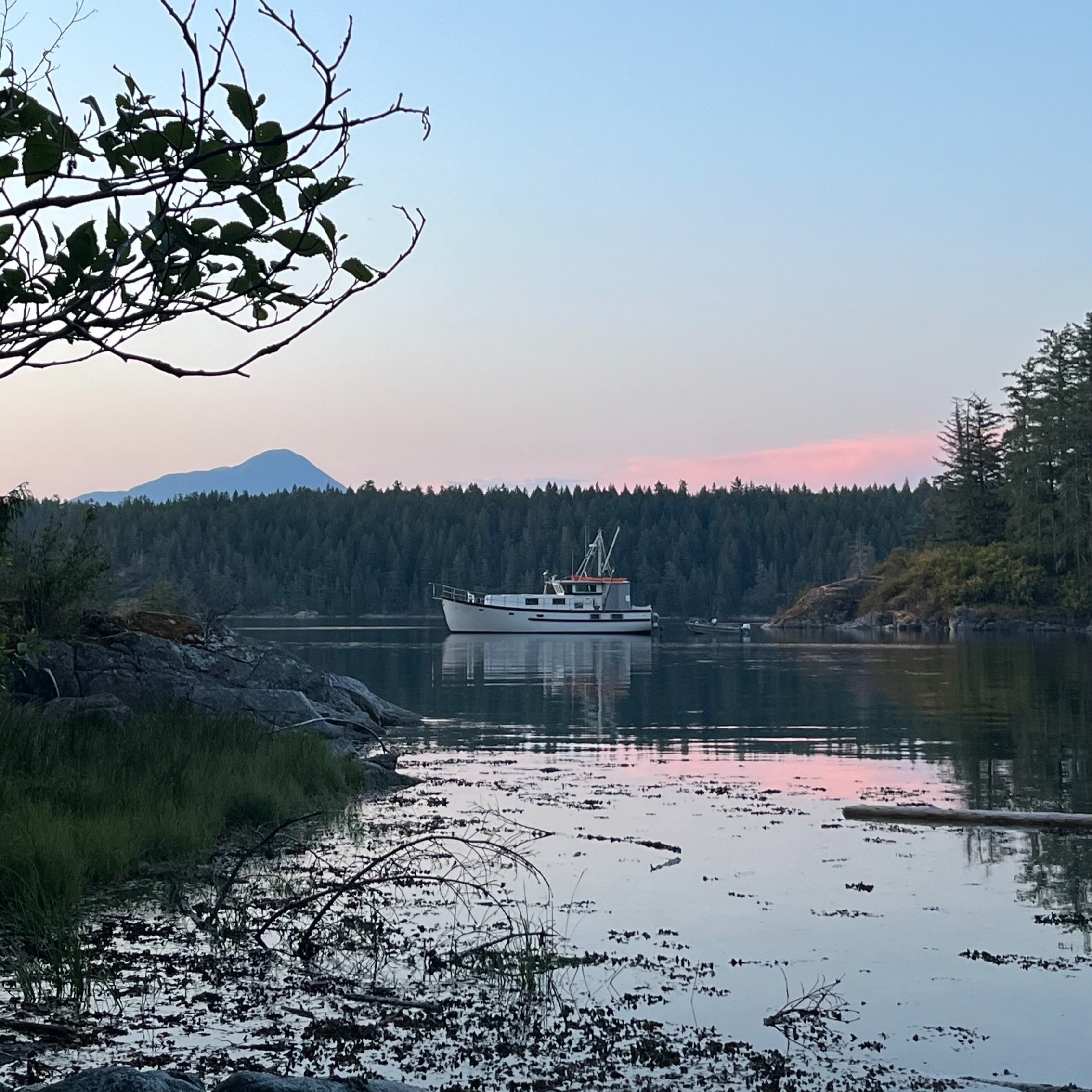
Compass Rose anchored in Eucott Bay

Sushi is a good way to make a little fish look great on a plate.


The elastic anchor rode on our stern anchor (an Anchor Buddy) really was useful on this trip. Here it is seen holding the skiff pulled in for loading after it sat further away from the shore as the tide went out. This added piece of mind while we soaked and watched for the Grizzly to return to the Hotspring. It would be bad to let your dinghy dry out when you have to escape to the safety of the water. I would add that a skiff like this is really well suited to the waters. Tough and light for its capacity it increases the range of exploration.

Eucott Bay Hotsprings
Day 14-
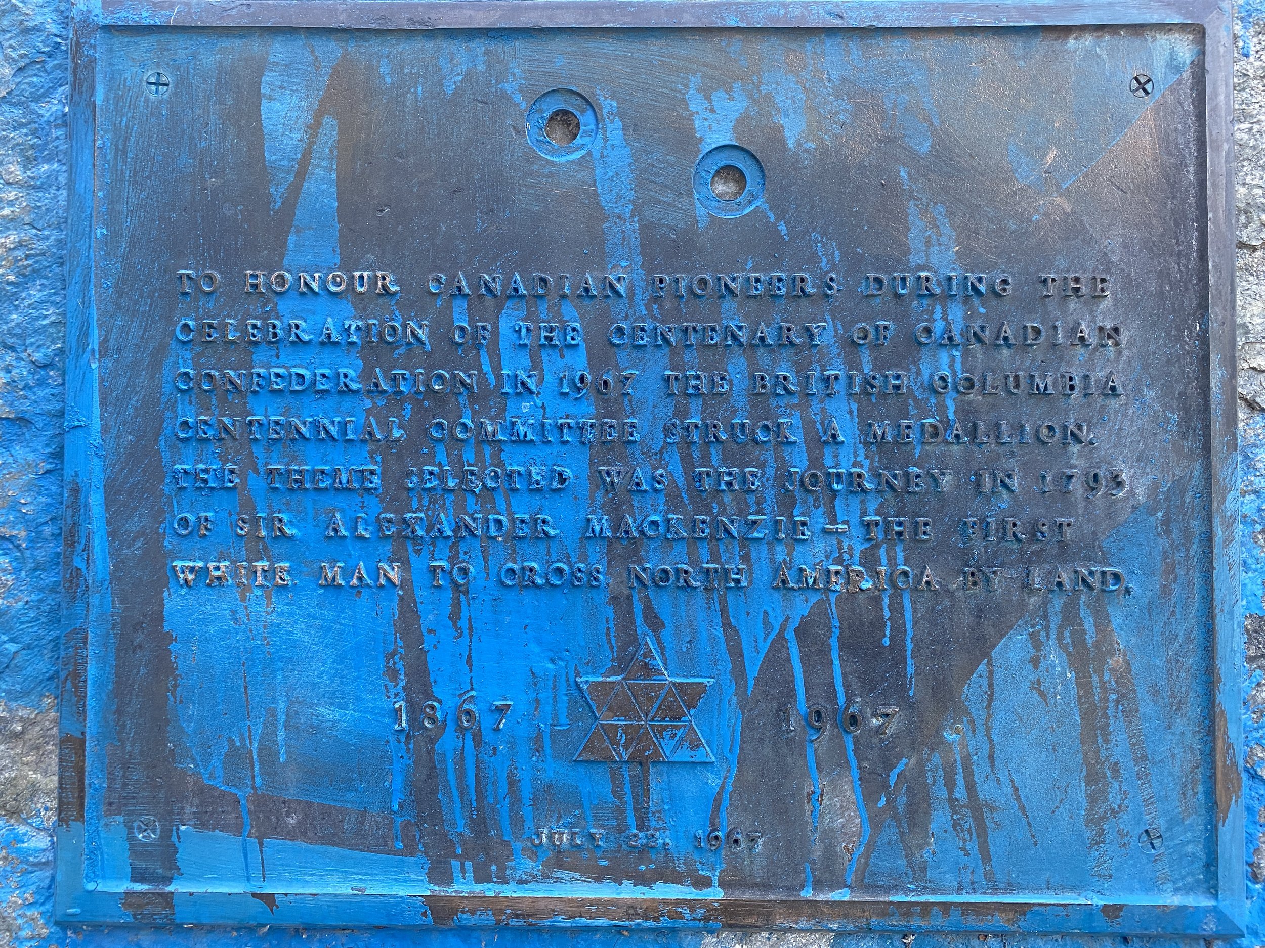
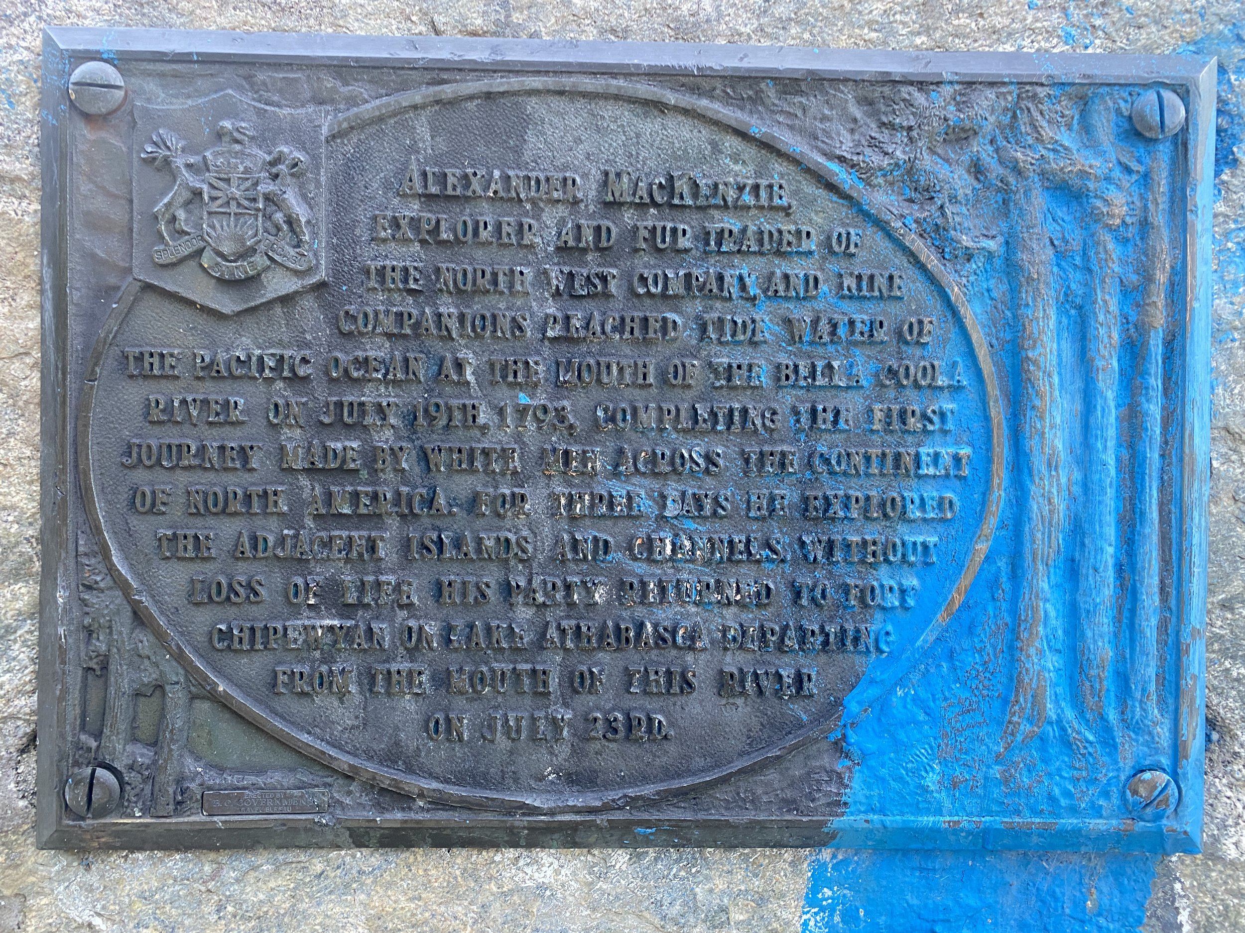
Bella Coola
I think this is a place we could have explored more and a better provision option than Bella Bella because of the farmland not far inland. Fallon and I went to the one bar on the reservation here and talked to some locals and they said that the wolves and bears are coming into the village these days because of food scarcity and people’s pets are being killed. Overfishing has effected this area significantly.
Always sad to leave or end an adventure but a great opportunity to explore new places and I’ll at least have some good resting spots in mind on the next delivery through these waters.


The Canadian Indian residential school system was a network of boarding schools for Indigenous peoples. The network was funded by the Canadian government's Department of Indian Affairs and administered by Christian churches. The school system was created to isolate Indigenous children from the influence of their own culture and religion in order to assimilate them into the dominant Canadian culture. Over the course of the system's more than hundred-year existence, around 150,000 children were placed in residential schools nationally. By the 1930s, about 30 percent of Indigenous children were attending residential schools. The number of school-related deaths remains unknown due to incomplete records. Estimates range from 3,200 to over 30,000, mostly from disease.

This is a beautiful and tasteful example of how graffiti can offer a critique of the establishment. One person’s pioneer hero is another person’s usurper. It is a complicated tangle of issues but mostly a sad tale of the destructiveness of colonialism in the not-so-distant past. I really hope there is healing and regrowth in these communities.